


Projects
Stormwater Retrofit Design – Ambler Way & Mt. Kisco Commons
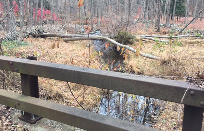
PR-CR-601, Ambler Way/Cross Road, Pound Ridge, NY
HVEA was responsible for the design of a stormwater retrofit project at this site. This project is to be installed on municipal property located at the intersection of Route 124 and Cross Road, a small roadway which has been abandoned. This location receives runoff from a 5-acre drainage area, mostly comprised of wooded area, and NYSDOT Route 124. The stormwater flows mostly by sheet flow to an existing pipe crossing at Route 124, where it crosses under the road and enters the site. Runoff also channel flows along the edge of the road towards the project site. From there, that stormwater flows north via open channel towards the NYSDEC classified stream. HVEA investigated the feasibility of infiltration trenches and concluded that other practices would be more suitable. HVEA designed a soil restoration project to convert impermeable area into forested land.
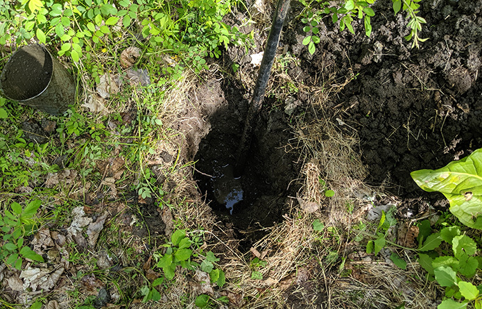
HVEA staff performed a soils analysis of the site using infiltration testing to determine the depth to water table and hydrologic soil groups of the soils on site. The staff sent soil samples to HVEA’s lab for gradation analysis, performed by HVEA’s lab technicians. HVEA then developed a HydroCAD model for the site to find peak flow values and determine the optimal stormwater treatment practice for reducing the phosphorous loads on the site and developed a design report and plans with the recommended stormwater retrofit practice and corresponding phosphorus removal and credits.
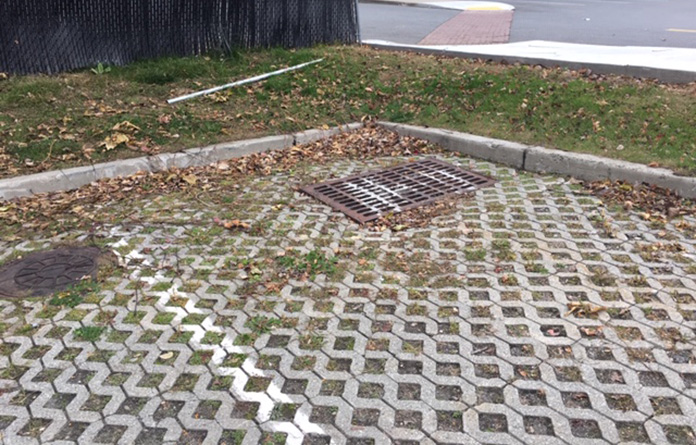
MK-NC-602, Mt. Kisco Commons, Mt. Kisco, NY
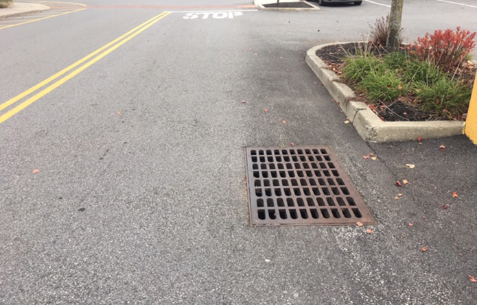
HVEA was responsible for the design of catch basin filters for phosphorous removal credits within this private parking lot. The Mount Kisco Commons shopping area is a commercial lot with several buildings on site and a high impervious area. The site has limited stormwater runoff treatment in the form of two (2) particle separators. These are located at the northwest corner of the shopping area and at a central point along the southern boundary of the property. It is estimated that these separators are treating 10 acres of the parking area. An area of approximately 2.9 acres flows offsite with no existing treatment.
HVEA staff developed a basemap for the parking lot site using the TopCon Total Station and Trimble GPS surveying equipment and used the survey data to delineate drainage areas for hydrologic calculations. The staff developed a hydrologic model in HydroCAD, using land use cover, rainfall data and drainage patterns of the parking lot. Peak flow volumes were calculated using HydroCAD modeling, and then used to size the catch basin filters for each drainage basin to optimize phosphorous removal and calculate the total change in phosphorous load for the site.